NASA’s Mars Reconnaissance Orbiter (MRO) officially went into service above the Red Planet in November 2006. The spacecraft has since spent nearly 20 years circling Earth’s closest neighbor, studying its geology and identifying icy evidence of a once watery world. After already sending back more than 450 terabits of data over the course of its ongoing mission, the orbiter recently passed a major milestone: its 100,000th image of the Martian surface.
Taken on October 7 by the spacecraft’s High Resolution Imaging Science Experiment (HiRISE), the portrait includes sandscapes, steep dunes, and even a few ancient impact craters inside Syrtis Major. The region on display is located only about 50 miles southeast of Jezero Crater, where NASA’s Perseverance rover continues its own on-the-ground exploration of Mars.
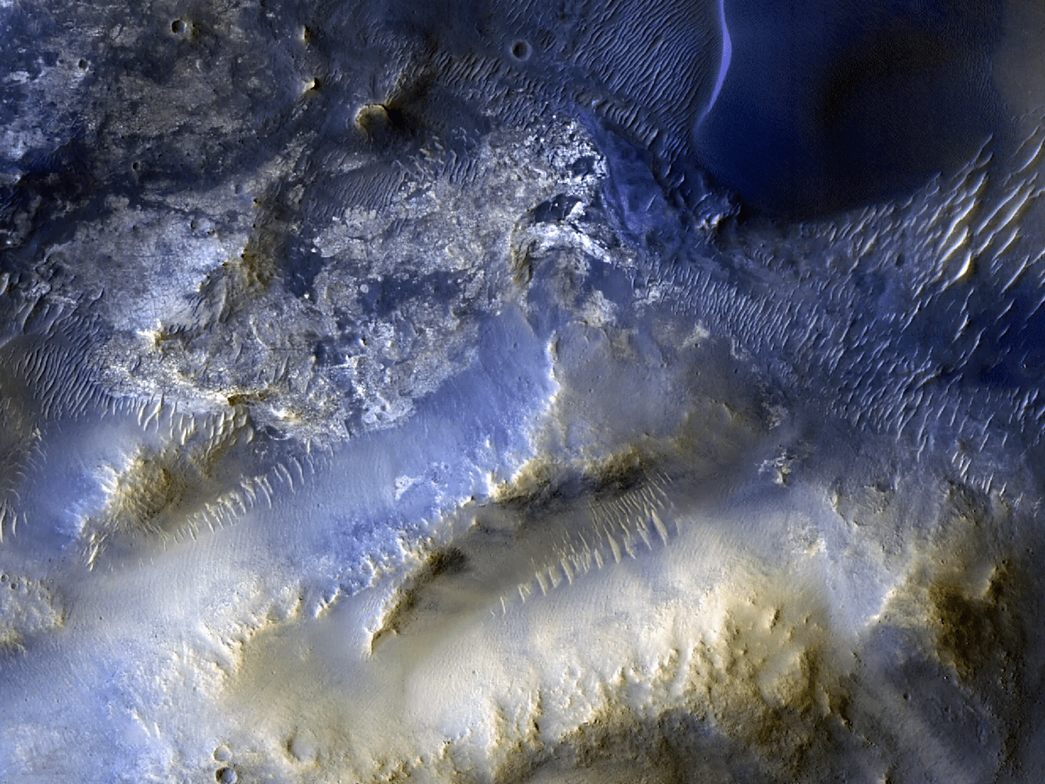
Photographs from HiRISE don’t only illustrate the Red Planet’s grandeur. The details in each image help researchers learn more about conditions on Mars ahead of the first human visitors.
“HiRISE hasn’t just discovered how different the Martian surface is from Earth, it’s also shown us how that surface changes over time,” MRO project scientist Leslie Tamppari at NASA’s Jet Propulsion Laboratory said in a statement. “We’ve seen dune fields marching along with the wind and avalanches careening down steep slopes.”
The 100,000th image’s subject matter wasn’t chosen after deliberation at mission control. Instead, the region was nominated by a high school student through HiWish, NASA’s website portugal for suggesting regions of Mars to study.
“Rapid data releases, as well as imaging targets suggested by the broader science community and public, have been a hallmark of HiRISE,” explained Shane Byrne, HiRISE’s principal investigator at the University of Arizona in Tucson. “100,000 images just like this one have made Mars more familiar and accessible for everyone.”
For even more immersive looks at Mars, Bryne and colleagues have also constructed 3D models that allow anyone to experience virtual flyovers of the planet.